The Comparative Archaeology Database provides datasets in formats chosen for their longevity, ease of archiving, and broad compatibility. We prioritize formats that are simple, widely supported, and easily importable into various research tools. However, we also recognize that researchers use different software, so in many cases, we provide data in both a standardized format and the original format used by the researcher.
Each dataset includes metadata (data dictionary) detailing file structures, coordinate systems, and variable definitions. This documentation ensures that users can integrate and interpret the data correctly, regardless of the software they are using.
Tabular Data (Cases and Variables)
Most datasets include tables where rows represent cases (such as sites, artifacts, or samples) and columns contain variables describing them.
- We use comma-separated values (.csv) files because they are simple, non-proprietary, and compatible with virtually all statistical and spreadsheet software. Some datasets use .txt as an alternative extension for CSV files.
- To accommodate researchers' original formats, some datasets also include spreadsheet files (.xlsx) or ArcGIS tables, which may be more convenient for certain workflows.
Spatial Data
For datasets with spatial information, we provide both vector and raster formats to maximize usability.
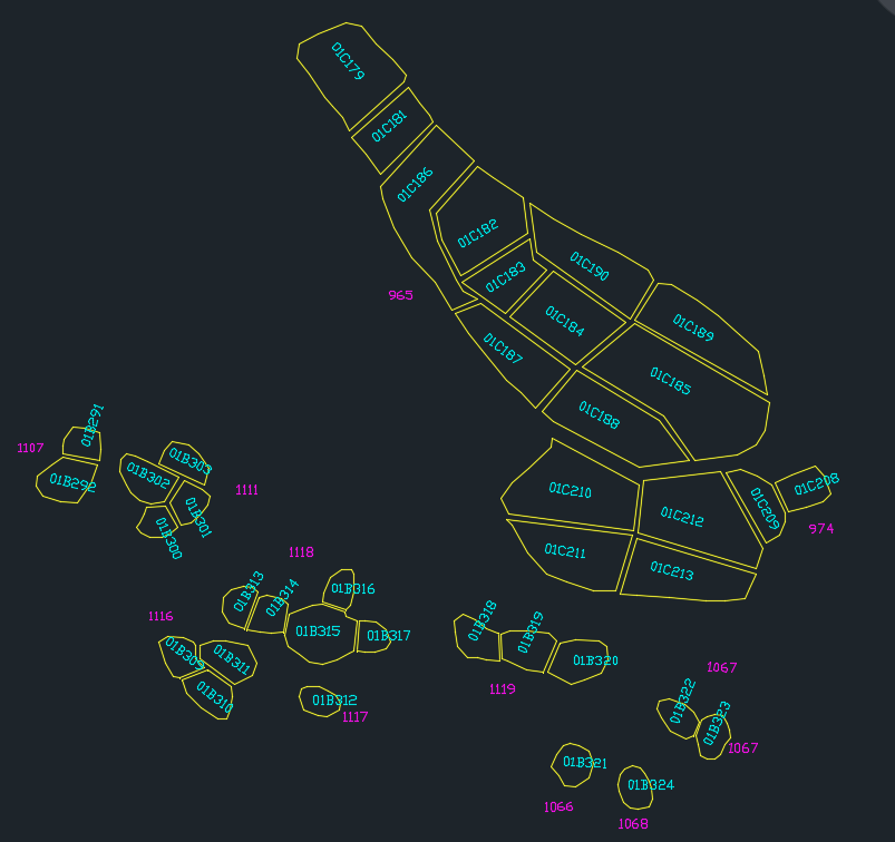
Vector Drawings
For vector drawings, we provide AutoCAD DXF (Drawing Exchange Format) files with the extension .dxf because they are widely supported across GIS and CAD software, easy to import, and well-suited for long-term archiving. Most GIS programs can work with DXF files, even if they handle georeferencing differently, which is why coordinate system details are provided separately in the metadata (data dictionary) of each drawing.
In some cases, datasets also include original files in proprietary formats (such as ArcGIS shapefiles) when they were part of the researcher’s original dataset.
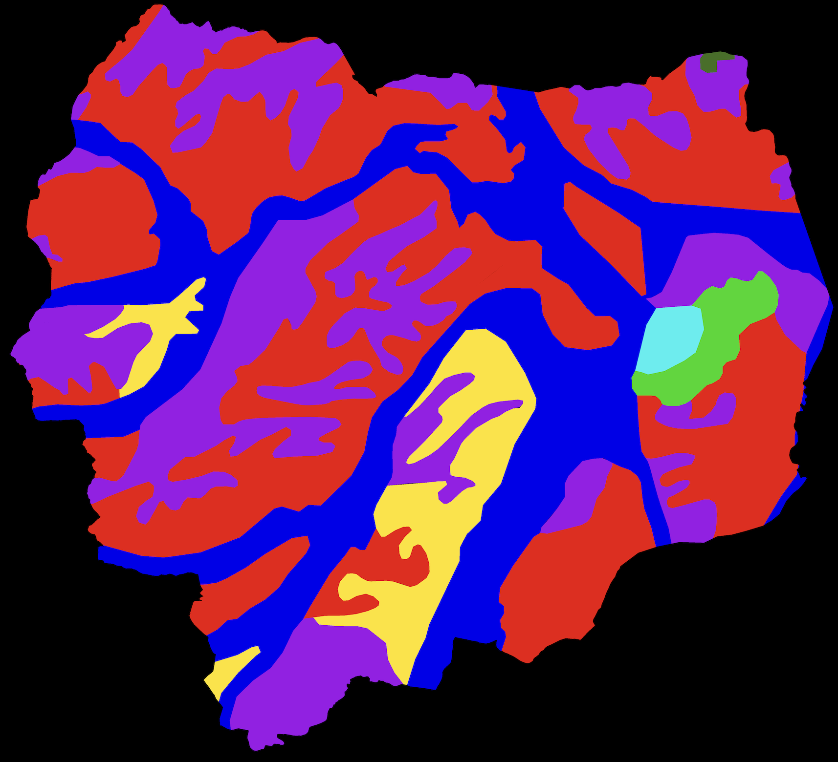
Raster Imagery
Raster imagery, such as DEM maps or environmental data, is provided in GeoTIFF (.tif) format, which embeds georeferencing data into the data file.
Raster imagery may also provide the original files in proprietary formats when they were part of the researcher’s original dataset.
For Authors
Close collaboration with us is often the best approach when preparing your data files. We encourage you to reach out to us as you prepare your dataset. Traditionally, we have worked closely with authors to ensure their files are formatted correctly, and we can often create CSV and DXF files on your behalf to ensure compatibility with the database.
For those wishing to convert GIS data to georeferenced DXF files on their own, we offer a step-by-step guide adapted from an ESRI walkthrough for ArcGIS Pro. This guide explains how to create georeferenced DXF files with attribute IDs formatted as text strings, ensuring the insertion points fall within the polygons they represent.