Locational Information
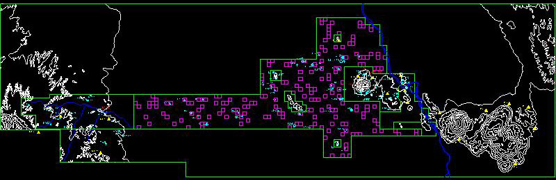
Locational information is provided as an AutoCAD (Release 12) .DXF file named MAP.DXF. An ArcGIS .SHP file is also provided, containing the same information, which has been compressed into a .ZIP file named MAP.ZIP. The coordinate system is WGS84 UTM 19S expressed in meters.
The layers the .DXF drawing and their contents are as follows:
-
BORDER--a rectangle enclosing the regional map
- SURVEY_AREA--an AutoCAD polyline enclosing the total area surveyed by a combination of full coverage and sampling
- FULL_COVERAGE--AutoCAD closed polylines enclosing the areas subjected to full-coverage survey
- MINE--an AutoCAD closed polyline enclosing the area of mining activity
- SAMPLE_AREA--the area surveyed by statistical sampling
- SAMPLE_SQUARES--the actual sample squares that were surveyed
- CONTOURS--the contours describing the topography of the region
- RIVERS--the two rivers in the region
- WANKARANI_SITES--symbols indicating the locations of different kinds of sites of the Wankarani period
- WANKARANI_SITE_NOS--text labels consisting of the site numbers for sites of the Wankarani period
- JACHAKALA_SITES--symbols indicating the locations of different kinds of sites of the Jachakala period
- JACHAKALA_SITE_NOS--text labels consisting of the site numbers for sites of the Jachakala period
- LATE_INT_SITES--symbols indicating the locations of different kinds of sites of the Late Intermediate period
- LATE_INT_SITE_NOS--text labels consisting of the site numbers for sites of the Late Intermediate period
Return
to Table of Contents