Comparative Archaeology Database, University of Pittsburgh
URL: http://www.cadb.pitt.edu
Email: cadb@pitt.edu

Talgar Alluvial Fan Dataset
Claudia Chang and Perry A. Tourtellotte

Color-coded Environmental Maps

The following maps complement the report "Characterization of Ecosystems of Archaeological Excavations Area in the Talgar River Basin" (accesible through the main page of this dataset). The legend for each map is described in detail in the report, and below each image we provide the correponding report pages where the legend appears.


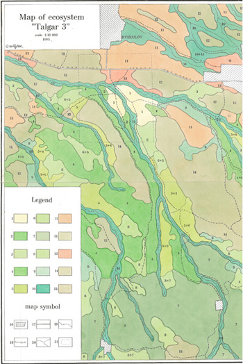
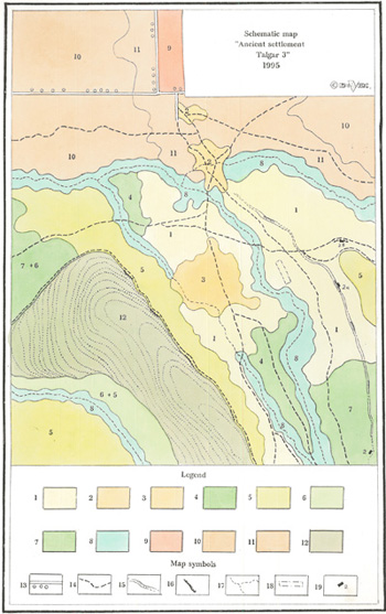
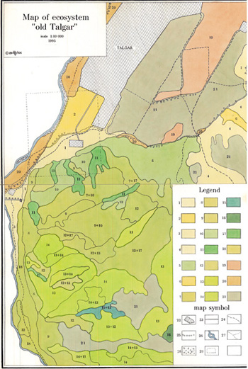
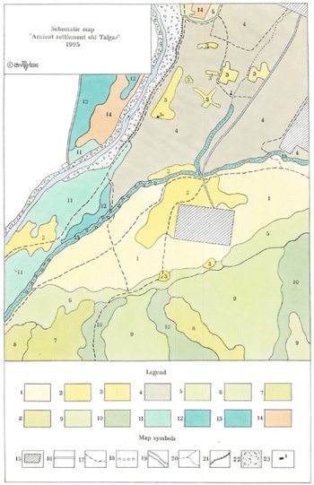
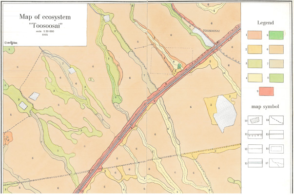
Map of Ecosystem "Toosoosai"
Legend in Pp. 25-29 of report

Download high-resolution (300 DPI) TIFF image (18.8 MB)


Map of Ecosystem "Talgar 3"
Legend in Pp. 52-55 of report

Download high-resolution (300 DPI) TIFF image
(18.6 MB)


Schematic Map, "Ancient Settlement Talgar 3"
Legend in Pp. 56 of report

Download high-resolution (300 DPI) TIFF image
(14.7 MB)


Map of Ecosystem "Old Talgar"
Legend in Pp. 75-79 of report

Download high-resolution (300 DPI) TIFF image
(34.8 MB)


Schematic Map, "Ancient Settlement Old Talgar"
Legend in Pp. 80-82 of report

Download high-resolution (300 DPI) TIFF image
(14.3 MB)


Return to the Table of Contents