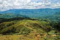
Figure 2.1. Rolling land in the western survey zone, sharply divided by deeply incised quebradas.
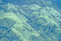
Figure 2.2. Steep slopes with small tambos in the western survey zone.
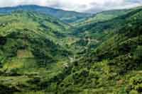
Figure 2.3. Patches of cultivation interspersed with uncultivated land in the western survey zone.
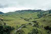
Figure 2.4. Extensive cattle pasture in the western survey zone.
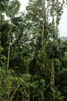
Figure 2.5. Dense forest vegetation in the western survey zone.
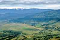
Figure 2.7. Broad natural terraces of the Río Páez in the eastern survey zone.
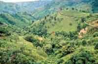
Figure 3.4. Steep slopes above La Argentina in the western survey zone.
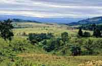
Figure 3.7. Gentle slopes along the summit of the Serranía de las Minas in the western survey zone.
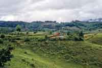
Figure 3.8. Gentle slopes near Belén in the western survey zone.
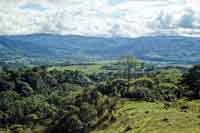
Figure 3.9. Gentle slopes near La Argentina in the western survey zone.
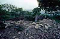
Figure 3.16. Looted burial mound at Cerro Guacas.
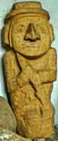
Figure 3.17. Statue of human figure with spear from Cerro Guacas.
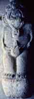
Figure 3.18. Statue of human figure with trophy head from Cerro Guacas.
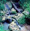
Figure 3.19. Carved bedrock at La Fuente.
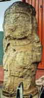
Figure 3.20. Statue now at the school in the vereda of Lourdes.
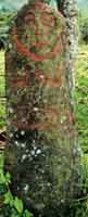
Figure 3.21. Low-relief sculpture of human figure at VP211.
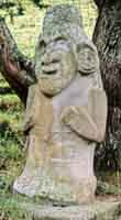
Figure 3.22. Statue of human figure at Aguacatal.
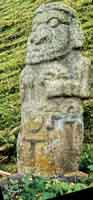
Figure 3.23. Statue of human figure at Aguacatal.
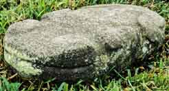
Figure 3.24. Reptilian statue at Aguacatal.
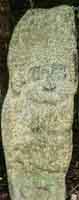
Figure 3.25. Statue of human figure at El Cedro.
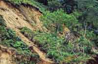
Figure 3.34. A landslide in soilscape C1, the ignimbrite high plain. Vegetation, a barbed-wire fence, and posts supporting a hose to supply water to a rural house have all slid down the slope intact.
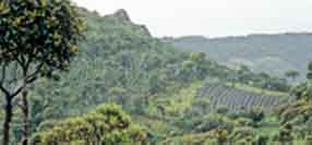
Figure 3.35. High-elevation potato cultivation on field ridges created to improve soil drainage in the western survey zone.
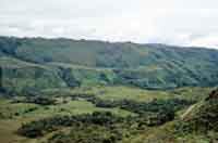
Figure 3.38. Extremely sparse modern rural settlement in the western survey zone.
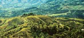
Figure 3.39. Denser but still dispersed modern rural settlement in the western survey zone.

Figure 3.40. Nucleated settlement within the modern town of La Argentina.
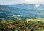
Figure 3.41. View of the modern nucleated town of La Argentina.
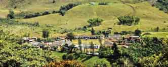
Figure 3.44. Modern nucleated small community of El Pensil.
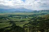
Figure 4.4. Broad flat high and low terraces of the Río Páez in the eastern survey zone.
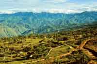
Figure 4.5. Slopes on the ridge between Tesalia and Nátaga in the eastern survey zone.
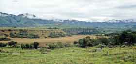
Figure 5.1. Broad flat high terraces of the Río Páez at the eastern end of the central survey zone.
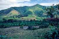
Figure 5.2. Narrower valley of the Río La Plata above the town of La Plata in the central survey zone.