|
Comparative Archaeology Database, University of Pittsburgh
|
|
Upper Daling Region Settlement Dataset |
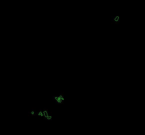
All surface artifacts were flagged in a total of about 16 ha at Dongshanzui, Sanjia, and Erbuchi in order to detect visually areas of highest surface densities (see printed volume, Chapter 3). This map delineates the boundaries of those areas. It is provided in vector format as an AutoCAD DXF file. In the file, AutoCAD closed polylines delineate polygons within which surface artifacts were flagged. One file includes the entire Upper Daling region. Of the three areas of work, Dongshanzui is in the center; Erbuchi, to the north; and Sanjia, to the south.
Low-resolution preview |
Download the file FLAG.DXF (39 KB). |